Brøndby Municipality (Brøndby Kommune)
 |
The site of its municipal council is the town of Brøndbyvester. Neighboring municipalities are Hvidovre to the east, Rødovre to the north, Glostrup to the north, Albertslund to the northwest, and Vallensbæk to the west. To the south is Køge Bay (Køge Bugt).
The geography of Brøndby municipality was not affected by the nationwide Kommunalreformen ("The Municipality Reform" of 2007) on 1 January 2007.
Brøndby consists of three cities: Brøndbyvester (west), Brøndbyøster (east) and to the south Brøndby Strand.
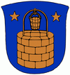
Brøndbyvester is the "original" Brøndby and has several old farmhouses, but mostly consists of single family houses - this is a typical middle-class Danish suburb. Brøndby's name in Danish combines both "water well" and "town".
Brøndbyøster is east of the big intersection that parts the three different Brøndbys. (Brøndby Strand Projects 93), this part of the city has many older people and immigrants.
Brøndby Strand is a mix of those two cities. There are lot of single-family houses and 12 high-rise residential estates. It is the only area in Denmark where more than 50 percent of the population aren't Danish-born, nor of Danish descent. These four neighborhoods are also known as the Southside or Southcoast Copenhagen.
Brøndby is the home of Brøndby IF, a football club.
Map - Brøndby Municipality (Brøndby Kommune)
Map


Country - Denmark
 |
 |
| Flag of Denmark | |
As of 2013, the Kingdom of Denmark, including the Faroe Islands and Greenland, has a total of 1,419 islands above 100 m2; 443 of which have been named and of which 78 are inhabited. Spanning a total area of 42943 km2, metropolitan Denmark consists of the northern part of the Jutland peninsula and an archipelago of 406 islands. Of these, the most populated island is Zealand, on which the capital Copenhagen is situated, followed by Funen, the North Jutlandic Island, and Amager. Denmark's geography is characterised by flat, arable land, sandy coasts, low elevation, and a temperate climate. As of 2022, it had a population of 5.928 million (1 October 2022), of which 800,000 live in the capital and largest city, Copenhagen. Denmark exercises hegemonic influence in the Danish Realm, devolving powers to handle internal affairs. Home rule was established in the Faroe Islands in 1948 and in Greenland in 1979; the latter obtained further autonomy in 2009.
Currency / Language
| ISO | Currency | Symbol | Significant figures |
|---|---|---|---|
| DKK | Danish krone | kr | 2 |
| ISO | Language |
|---|---|
| DA | Danish language |
| EN | English language |
| FO | Faroese language |
| DE | German language |